Fly to Oregon - May 3, 2008
May 3, 2008: This Saturday started with rain in
Chattanooga before my mid-day commuter flight to Atlanta and my non-stop flight to
Portland, Oregon. This is the beginning of a business trip for my day job.
Before it is over, I will go to Bend, Oregon by car with a sales associate, then up to
Seattle before returning home on May 8. I had a late lunch at the Atlanta airport
and picked up a sandwich to take on the 5-hour flight that pushed back from the gate as
sheduled at 4:55 PM. I always book early enough to get a window seat. This
Boeing 757-2Q8 parked next to my 757 got my attention with its winglets. I wrote
down the N-number of N702TW to find out later the model number of this particular 757.
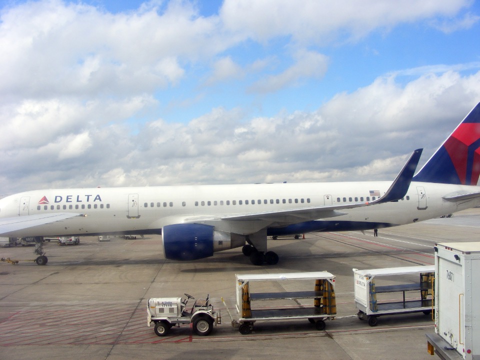
(UPDATED on May 5, 2008) I received an email
from another RV-builder who works at the Delta Airlines facility here in Atlanta. He
tells me this is one of several 757's recently acquired by Delta and modified by Timco
Aviation adding the winglets for greater range (ETOPS).
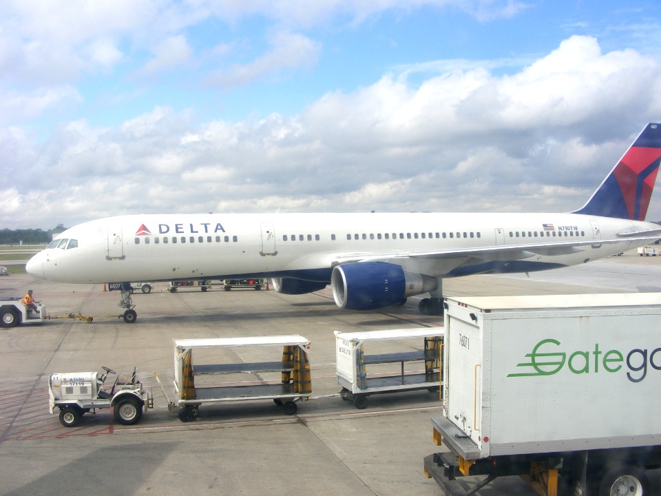
No sooner than the loaded 757 above departed, than a similar one replaced it.
It is part of the same lease as seen by the N710TW registration. This one
apparently came over from maintenance since it was towed into the gate, not taxied in as
it would be if it arrived with passengers. The winglet is just out of the photo on
this one.
My flight departed Atlanta and flew north to Chattanooga before turning on
course for Portland, Oregon. I followed the moving map display on the personal
monitor in front of me. The route went over Nashville and passed by Fort Campbell,
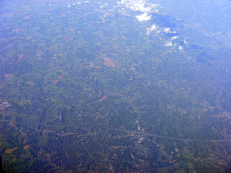
Kentucky on its way northwest. Central Missouri is filled with hills as evidenced by
the terrain contours. That super highway gives it away even further when the lanes
are separated on the steep hill side as seen below.
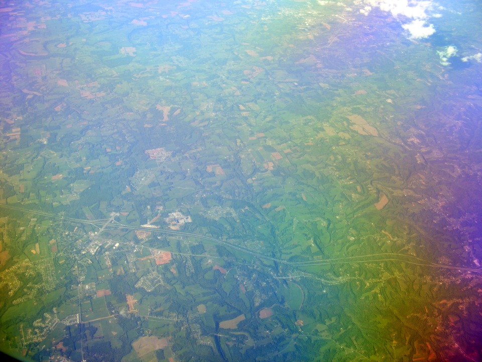
I was experimenting with the camera and my polarizing filter to show the
problems with trying to shoot aerial photography from an airliner cruising at 34,000 feet.
This shot has color variations due to the interaction between the polarizing filter
and the window panes. The photo above was taken without the polarizing filter, but
was post-processed in Corel Photo Paint to equalize the contrast, and brightness.
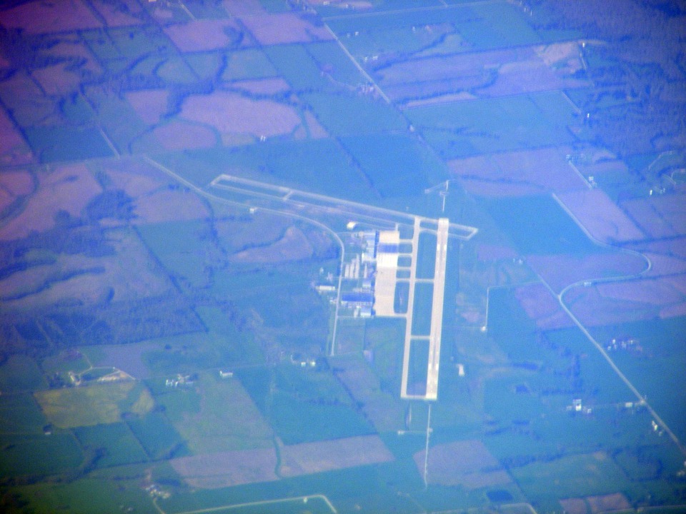
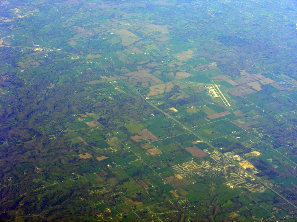
I pushed the telephoto button on my camera to get this shot of the Columbia,
Missouri airport.
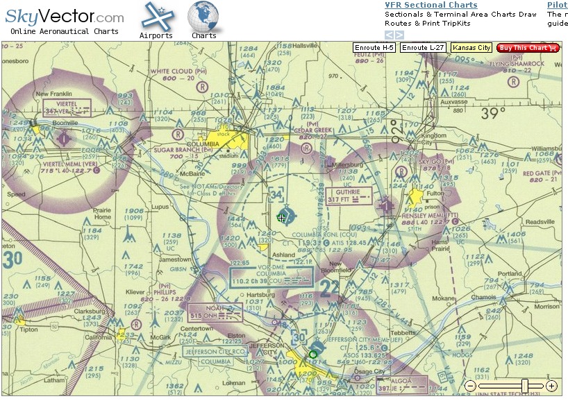
Here is the sectional map view of the airport.
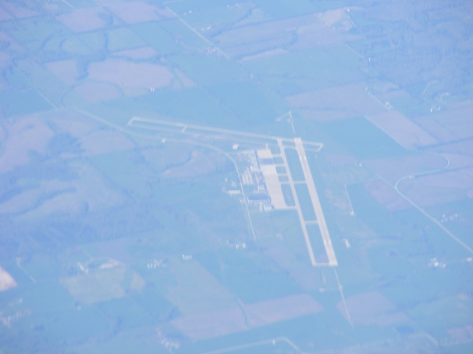
I took this second shot without the polarizing filter to show the actual haze
as seen from 34,000 feet.
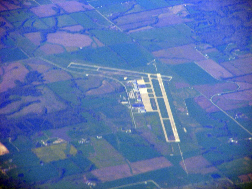
Here is that same photo after using "Auto Equalization" processing in
Corel Photo Paint. I am always amazed at the power of digital photographs to capture
details that are "unseen" in the normal view.
This is a wide-angle view of the Columbia Airport without the polarizing filter
and after auto-equilization post-processing. I would much rather have been seeing
this view from "Enterprise" at 12,500 MSL.
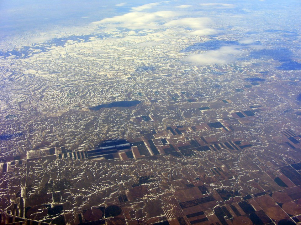
And here is the first of the snow along the route to Portland. This is
taken over western Nebraska and is also a processed photo. The snow became heavier
across Eastern Wyoming. My view of the ground was washed out by a solid layer of
clouds from Central Wyoming across most of Idaho. I got some views of the ground in
Idaho to confirm that I will fly up the Snake River Valley when I make the trip in my
RV-9A.
There were no more pictures taken on Saturday. The flight arrived on time
in Portland, Oregon. I am publishing this page to the web site from my hotel room at
the Portland Airport. The sales guy will be here within the hour and the road trip
for today will begin with about 200 miles to go to reach our destination today. We
meet the client tomorrow morning (Monday).