Wendell Folks Alaska Trip - Page 21.
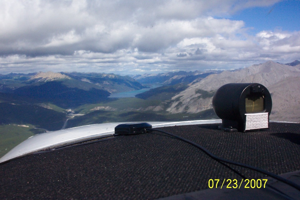
July 23, 2007: Day 4 continues going
northwest near Muncho Lake, BC. Wendell took this picture himself from the left seat
as his camera catches the first view of Muncho Lake. The time stamp on this photo
indicates 12 Noon Pacific Time. The GPS ground track shows 136 miles for the flight
from the Fort Nelson Airport to this point along the Alaska Highway.
This closer photo from Terry's camera provides a telephoto view of the lake.
The weather looks good up this way!
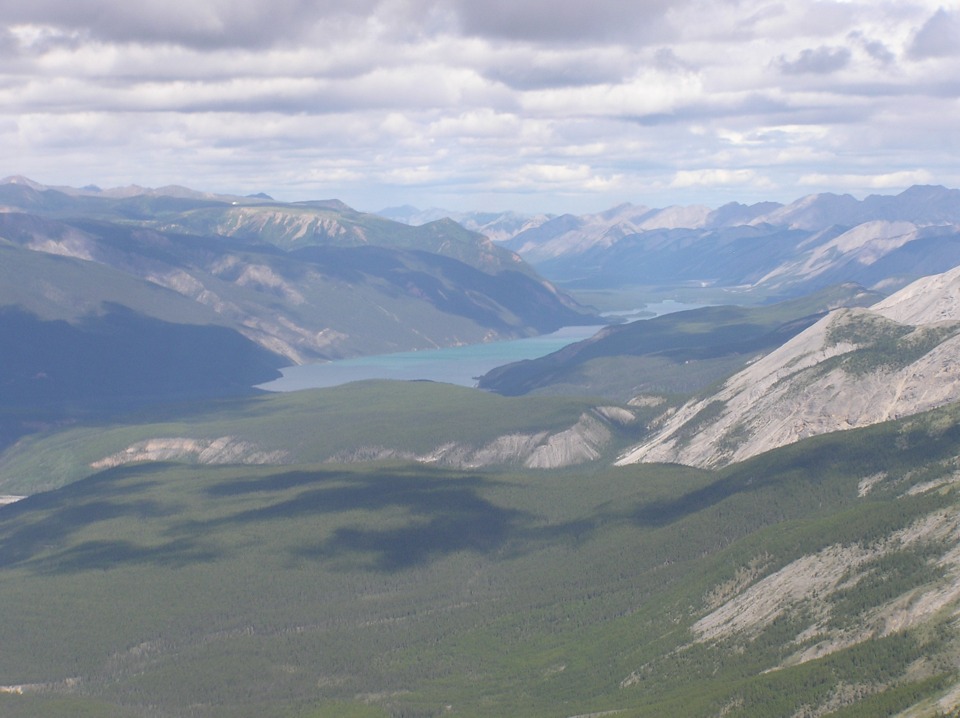
Muncho Lake is about 7 miles long. This photo shows the northern half of
the lake. The Alaska Highway hugs the shoreline on the right side of the lake.
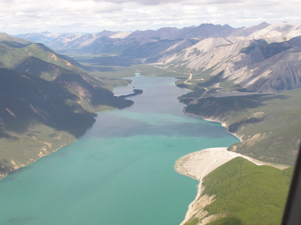
This view is looking almost due north as they make a slight turn to cross to the
West side of the lake.
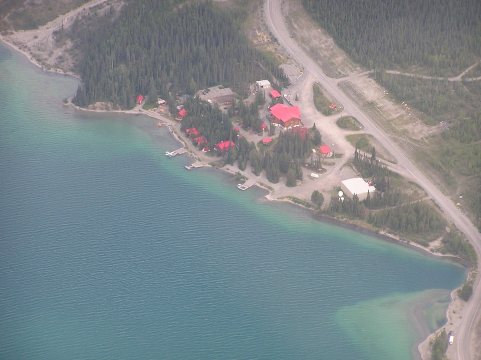
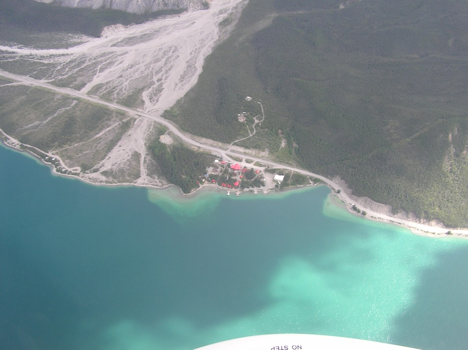
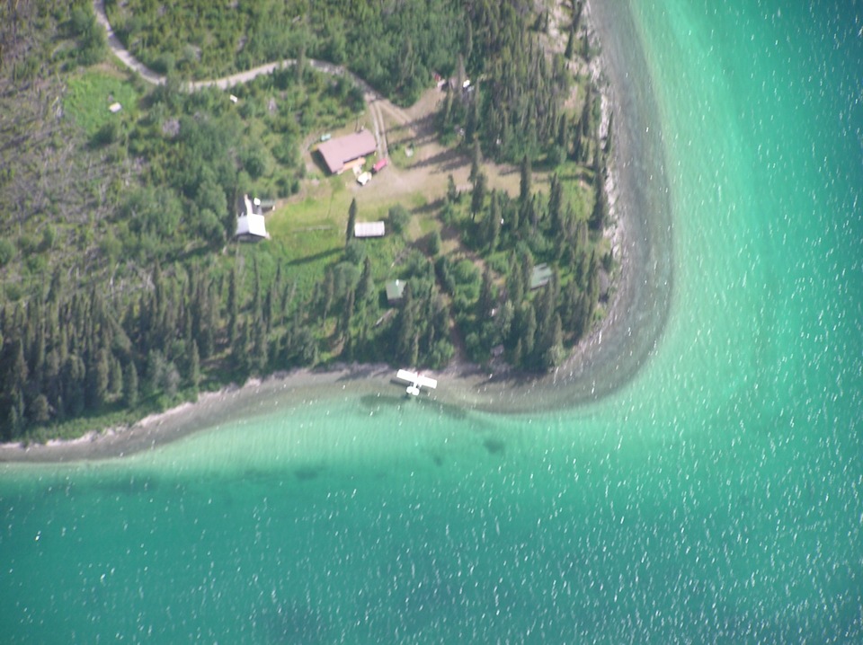
Terry once again does his telephoto thing on the resort here at Muncho Lake.
There is a float plane parked at the dock. What would life be without
satellite communications. Can you see the dish? This point on the Alaska
Highway is located at mile marker 462 from the beginning of the route at Dawson Creek.
This is the Northern Rockies Lodge and you can learn more about them at THEIR WEB SITE.
Here is the view without the telephoto zoom feature. It gives you the
"big picture" again of the campsite, motel, store, and the surrounding area near
the mid-point of the Eastern shore of the lake. For those of you who may not be
familiar with airplanes, that white shape with the words "NO STEP" is the wheel
fairing on the right main landing gear. The fairings reduce the wind resistance
(drag) and help the plane to fly faster and/or use less fuel.
This appears to be a private residence near the north end of the lake
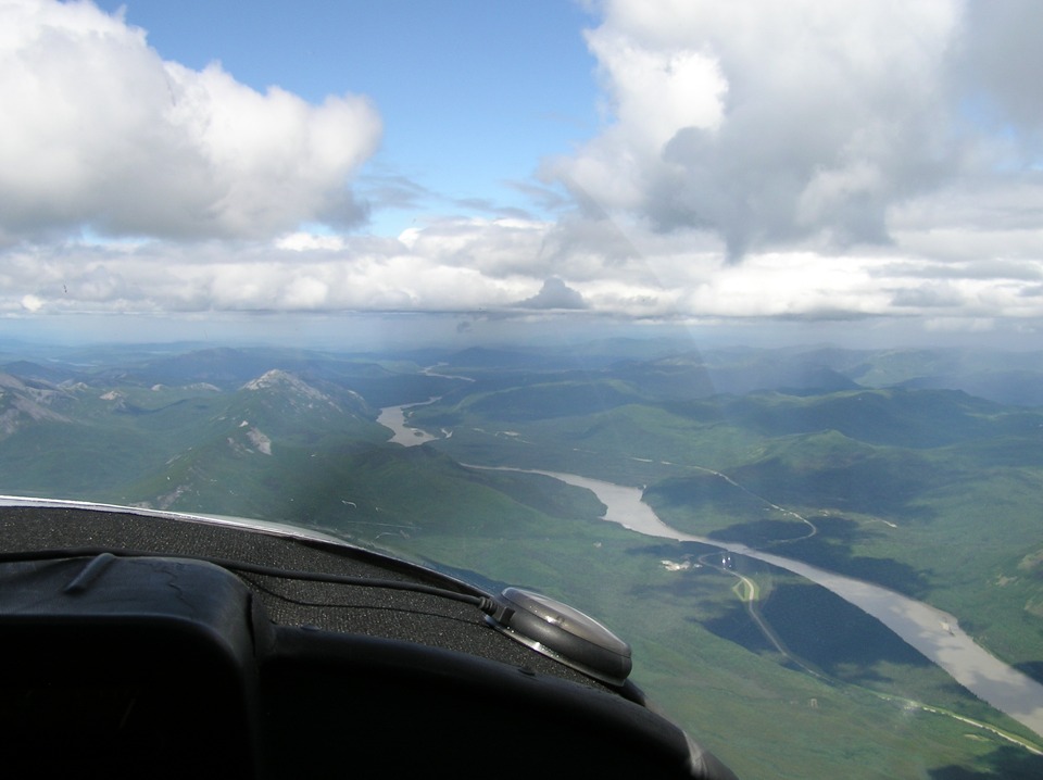
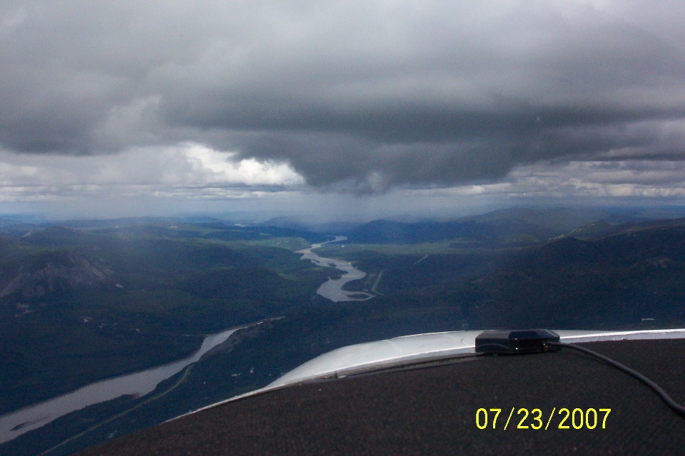
The Alaska Highway meets up with and crosses the Liard River about 27 miles
north of Muncho Lake. There appears to be more light rain ahead. The thing I
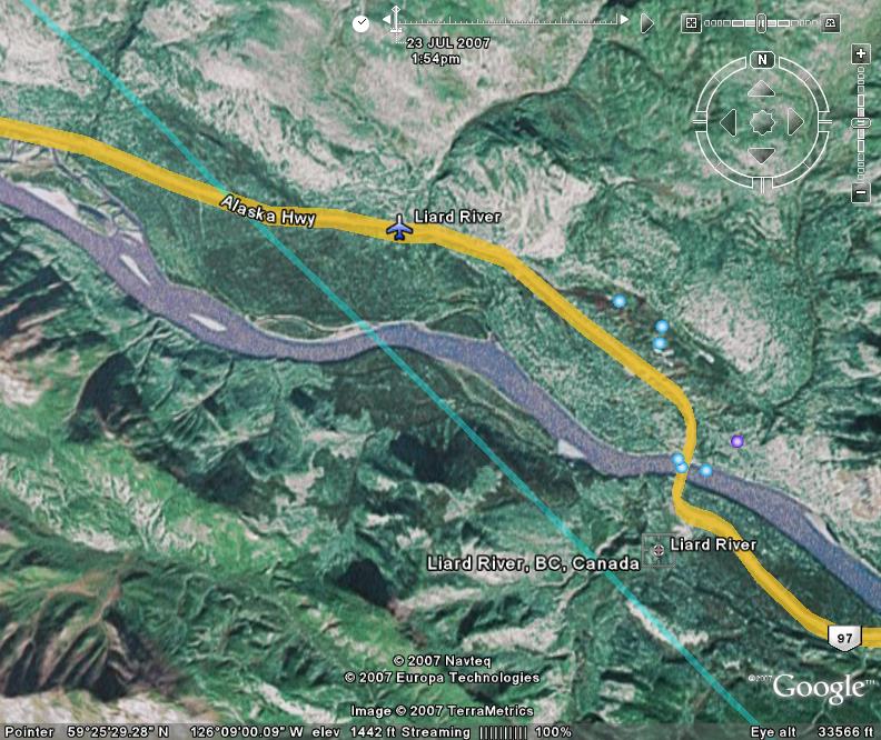
noticed on the GPS map is a non-directional homing beacon on the north side of the lake
adjacent to the highway in this photo. No airport is listed in the GPS data base.
Looking at the satellite photo and the overlay from Google, they are reporting
an airport at the same location as the non-directional beacon. The green line is
their GPS ground track through this area.
Here is Wendell's shot taken a bit further along the river.
| Alaska Trip - PAGE 22 | ALASKA MENU | MAIN MENU |